Table 6.194 — DRM_Property_Grid
|
Property |
Description |
|||||||||||||||
|---|---|---|---|---|---|---|---|---|---|---|---|---|---|---|---|---|
|
Class |
|
|||||||||||||||
|
Superclass |
||||||||||||||||
|
Subclass |
|
|||||||||||||||
|
Definition |
An instance of this DRM class is a <DRM Data Table> instance that has at least one but not more than three spatial axes that always appear before any other <DRM Axis> instances in its ordered list of <DRM Axis> instances. A spatial axis is a <DRM Axis> instance that describes sampling along one of the components of the spatial reference frame of the <DRM Property Grid> instance; hence it is directly useful for locating the sample values in space. To qualify as spatial, the <DRM Axis> instance shall match the spatial reference frame exactly, using a consistent specification (e.g., the same ORM, direction vector and (possibly scaled) units.
The spatial_axes_count field specifies how many axes of the given <DRM Property Grid> instance are spatial axes. This specifies up to three grid indices that identify the grid cell that contains the location corresponding to that specified by the <DRM Location 3D> component of the <DRM Property Grid Hook Point> aggregate of the given <DRM Property Grid> instance. The identified cell is the attachment cell of the given <DRM Property Grid> instance; it is where the <DRM Location 3D> instance is attached to the <DRM Property Grid> instance. The location_index shall specify a valid cell within the given <DRM Property Grid> instance; that is, the indices shall be within the appropriate bounds of the <DRM Property Grid> instance. Only the first spatial_axes_count entries of location_index are significant. This specifies the SRF within which the given <DRM Property Grid> instance is defined, rather than attempting to depend on the SRF of the context in which the instance appears. The griddedness of spatial positions is dependent on the properties of the SRF. Coordinate conversions and transformations are not, in general, linear, so that a set of points that form a regular array of positions in one SRF may not be regular in another SRF. Therefore, in order to preserve griddedness, a <DRM Property Grid> instance specifies a SRF in which the data positions form a grid. If data_present = TRUE (the default), the given <DRM Property Grid> instance contains cell values that can be extracted by invoking the appropriate API functions. Otherwise, if data_present = FALSE, the given <DRM Property Grid> instance does not contain any cell values, although it may provide everything else that a populated <DRM Property Grid> instance can provide. |
|||||||||||||||
|
Clarifications |
1 An association between a <DRM Property Grid> instance and a <DRM Feature Representation> instance indicates that the environmental object(s) represented by the <DRM Feature Representation> instance and the <DRM Property Grid> instance (or some specific cell data within that <DRM Property Grid> instance) have the semantic relationship indicated by the <DRM Base Association Data> instance on the association relationship. Each associated <DRM Property Grid> instance will indicate whether the entire <DRM Property Grid> instance or only some specific cell data within it is participating in the relationship in question. 2 An association between a <DRM Property Grid> instance and a <DRM Feature Representation> instance indicates that the environmental object(s) represented by the <DRM Feature Representation> instance and the <DRM Property Grid> instance (or some specific cell data within that <DRM Property Grid> instance) have the semantic relationship indicated by the <DRM Base Association Data> instance on the association relationship. Each associated <DRM Property Grid> instance will indicate whether the entire <DRM Property Grid> instance or only some specific cell data within it is participating in the relationship in question. 3 This indicates the kind of information represented by the <DRM Data Table>, such as terrain elevation or water characteristics. |
|||||||||||||||
|
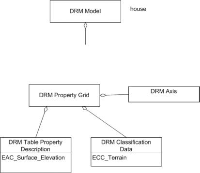
Class diagram |
||||||||||||||||
|
Inherited field elements |
|
|||||||||||||||
|
Field elements |
|
|||||||||||||||
Associated to (one-way) (inherited) |
|
|||||||||||||||
Associated to (one-way) |
|
|||||||||||||||
Associated by (one-way) (inherited) |
|
|||||||||||||||
Associated by (one-way) |
|
|||||||||||||||
Associated with (two-way) (inherited) |
|
|||||||||||||||
Associated with (two-way) |
|
|||||||||||||||
Composed of (two-way) (inherited) |
|
|||||||||||||||
Composed of (two-way) |
|
|||||||||||||||
Composed of (two-way metadata) (inherited) |
|
|||||||||||||||
Composed of (two-way metadata) |
|
|||||||||||||||
Component of (two-way) (inherited) |
|
|||||||||||||||
Component of (two-way) |
|
|||||||||||||||
|
Constraints |
||||||||||||||||
|
Example(s) |
|